
Alexander Hall
5 Simrishamn - Kivik
- Length
- 20 km
- Degree of difficulty
- Blue
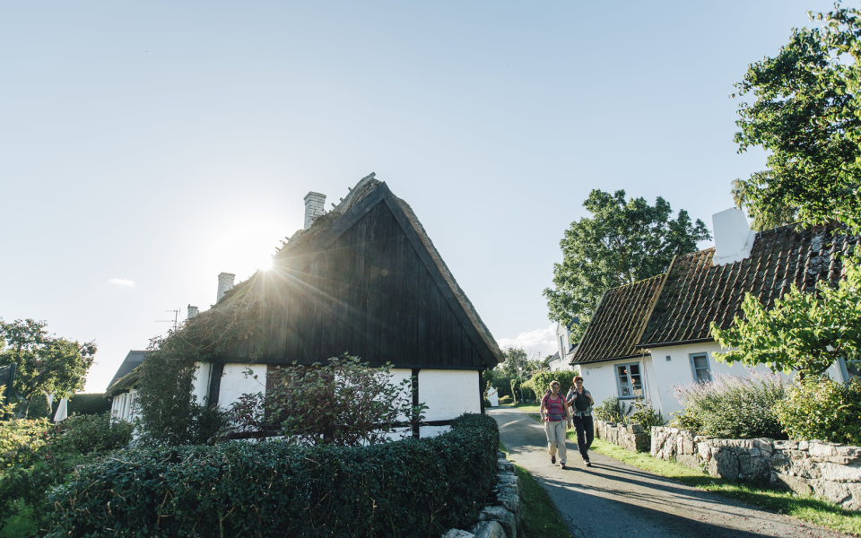
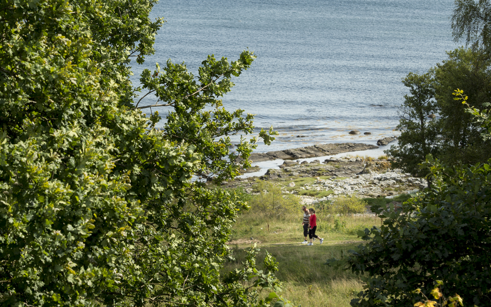
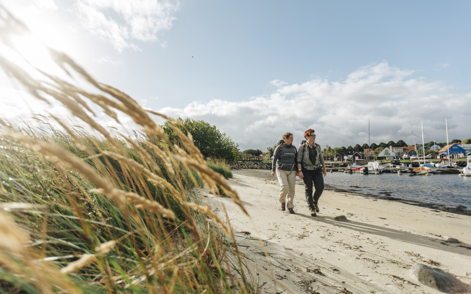
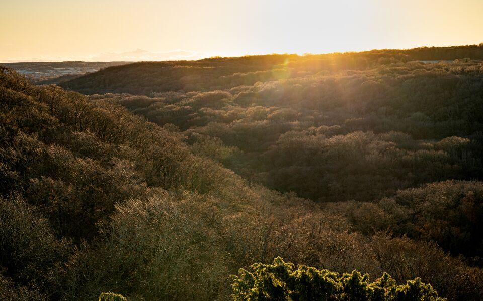
From the medieval town of Simrishamn, this stretch of trail includes sandy beaches, stony coastal meadows, woodland covered cliffs, and Stenshuvud National Park. Near Kivik, you can visit one of the largest Bronze Age stone burial mounds in northern Europe.
A varied stage featuring sandy beaches, boulder-strewn meadows, and wooded slopes. Along the way, you’ll encounter traditional fishing huts, rock formations, and Stenshuvud National Park. Enjoy apple orchards and local arts and crafts.
This stage takes you through typical Scanian fishing villages like Baskemölla and Vik, where people once made their living from fishing and farming. A hundred years ago, the entire coastline was used as pastureland, but during the 20th century, the forest began reclaiming the area. Here and there, you’ll spot broad-crowned trees that grew when they had room to spread out.
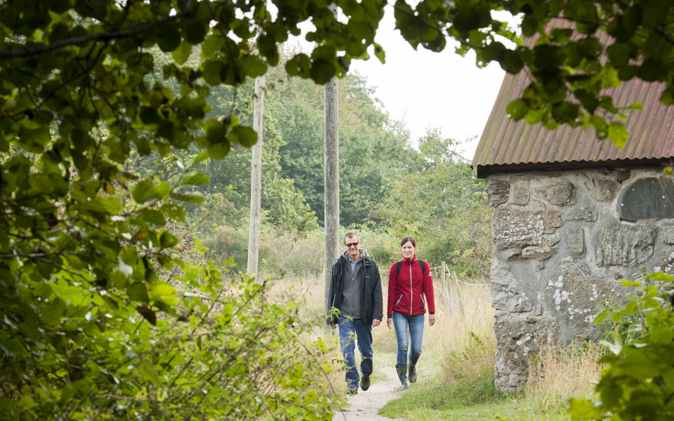
Between the villages, you pass through the cultural landscape around Tjörnedalagården, shaped by haymaking and grazing. On the hill southeast of the farm lies a cholera cemetery from 1855. At Tjörnedala, you walk through a recreational area with herb-rich deciduous forest, grazed meadows, and wildflowers such as orchids, pasqueflowers, and cowslips. According to Linnaeus, this was one of the most beautiful groves in the country.
Just north of Tjörnedala, you pass a sandstone formation known as "The Priest’s Bathtub" – a flower-shaped rock with half-meter-thick petals. Legend has it the priest used it for bathing. At Vik, the trail turns inland and continues past hills and cultivated land. The beach below is gradually being swallowed by the sea and is only walkable at very low tide.
Stenshuvud is an ancient cultural landscape that is still grazed today. As you hike toward the summit, you’ll pass a 210-meter-long wall – the remains of an ancient hillfort. It dates back to the Migration Period, around 400–550 AD. Near Kivik, you’ll also pass Bronze Age remains, the most prominent being the "King’s Grave" (Kungagraven) – a large burial cairn with beautifully carved stone slabs.
The hike through the national park and up the Stenshuvud hill is one of the tougher sections. At the foot of the hill, you’ll find dry heathland, swampy alder marshes, and orchid meadows, while from the summit you can enjoy sweeping views over Hanö Bay.
Rare birds, insects, and frogs inhabit the national park. South of the park, you can visit Knäbäckshusen – three fishing huts that were relocated here in 1956 from the Ravlunda military training grounds.
The final stretch toward Kivik follows a country road flanked by small pastures and an abandoned quarry, now home to rare small animals.
In nature reserves and national parks, special rules and restrictions apply to the Right of Public Access (Allemansrätten). Read more on the Swedish National Parks website.
20 km
Degree of difficulty
About Difficulty Grading
The grading is tailored for Swedish lowland trails that adhere to the quality criteria established by the national framework for hiking trails.
Even and firm ground: The terrain is generally flat. The hike requires no need to use your hands for support. No obstacles. Bridges are always present when crossing waterways.
Uneven and/or soft ground: Some changes in elevation. Certain sections may require hand support to maintain balance. There may be obstacles such as low stiles and short stairs. Minor obstacles like stones and roots. Boardwalks are present.
Loose or slippery ground combined with steep sections: Technical parts require hand support. There may be obstacles such as high stiles and longer stairs. Frequent sections with stones and/or roots. Boardwalks with deeper surrounding water.
Note: One or more of these features may be present along the trail section.
Blue
5-6 timmar
- Kustnära
- Skog
- Böljande
- Storslagna vyer
- 15-26 km
- Utmanande
- Kollektivtrafik
- Skåneleden
Highlights along the section
Are you looking for a place to stay or a cozy cafe during your hike? Here are some of the sights and places to visit along the section.
Hiking suggestions
Do you find it difficult to know where to start your hike? Here is some inspiration and a selection of recommended hikes - short and long, with or without accommodation or based on different themes.
Show allNews
Here you will find information about what's new on the trail as well as current redirections and disturbances.
Continue on the trail
Share your moments
Share your adventures on the trail by tagging your photos with #skåneleden or #skaneleden.