
Apelöga
13 Rebbetuaröd - Agusa
- Length
- 7 km
- Degree of difficulty
- Blue
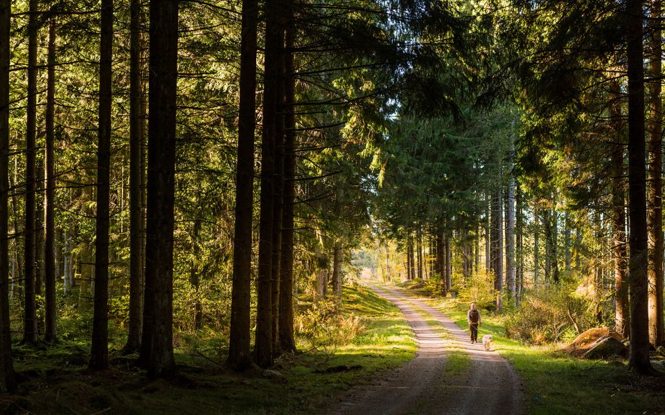
This section of trail in the northern part of southeast Skåne is a walk through dense beech forest and spruce plantations. You cross a top-secret area – not so top-secret anymore – where Swedish soldiers watched the skies during the Cold War. Pitch your tent near the quaint, quiet village of Agusa.
Nature
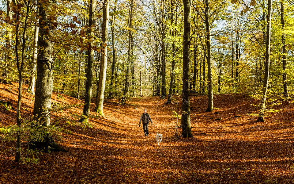
With this relatively short section of trail, you leave the Linderödsåsen Ridge behind as you wander more or less south, through the inland of southeast Skåne. The countryside around Rebbetuaröd is varied with fields, beech woodland, pastures and water courses. Keep your eyes open for the various rare and threatened butterfly species that have been spotted here.
To the south, you follow a gravel road through spruce plantation and along a boardwalk through a much more species rich wet forest. At Hallabjär forest tracks lead you through beech woodlands of varying age and character. Closer to Agusa the landscape once again opens up to pastures and fields. Along the gravel track that leads you into your campsite at Agusa, you pass Jären – one of the most impressive eskers in Skåne, and a part of Verkeåns Nature Reserve. This boulder ridge varies between 10-15 metres in height and is covered by a mix of deciduous and coniferous forest. Where there is meadow, the flora is rich, especially in the spring.
Pitch your tent at the Agusa campsite amongst tall beech trees. Right next to the campsite is a wildlife enclosure and even from the outside the odds are very good that you will spot red deer or wild boar, or perhaps you will hear them in the night.
Cultural History
There is plenty of history around Rebbetuaröd. You can find the remains of farms, drove roads, a mill, an old arched bridge and several small, earth cellars.
In the middle section of the trail is Hallabjär, one of the most top secret places in Skåne during the Cold War. A radar centre consisting of a 200-metre long tunnel and a three and a half storey underground building covering 400 square metres was situated here. From this centre, the military carried out surveillance of the skies 24 hours a day.
Look in under the spruce trees at the cross roads just north of Agusa for a sunken road. Over the centuries, boots, hooves and wagon wheels, together with soil erosion from rain, all contributed to wearing down the track, creating the hollow passage you see.
Agusa is a truly antiquated village, nestled in thick forest, with stone walls and several, well-preserved buildings, including Agusastugan, an old half-timbered cottage with a thatched roof – typical for Skåne. Anna Mårtensson lived here until 1944, and she left the cottage in the same condition as when she moved in. It is currently owned and maintained by the Albo Härads Local History Society and is open to the public.
7 km
Degree of difficulty
About Difficulty Grading
The grading is tailored for Swedish lowland trails that adhere to the quality criteria established by the national framework for hiking trails.
Even and firm ground: The terrain is generally flat. The hike requires no need to use your hands for support. No obstacles. Bridges are always present when crossing waterways.
Uneven and/or soft ground: Some changes in elevation. Certain sections may require hand support to maintain balance. There may be obstacles such as low stiles and short stairs. Minor obstacles like stones and roots. Boardwalks are present.
Loose or slippery ground combined with steep sections: Technical parts require hand support. There may be obstacles such as high stiles and longer stairs. Frequent sections with stones and/or roots. Boardwalks with deeper surrounding water.
Note: One or more of these features may be present along the trail section.
Blue
2-3 timmar
- Skog
- 1-7 km
- Lätt
- Hund
- Skåneleden
Highlights along the section
Are you looking for a place to stay or a cozy cafe during your hike? Here are some of the sights and places to visit along the section.
Hiking suggestions
Do you find it difficult to know where to start your hike? Here is some inspiration and a selection of recommended hikes - short and long, with or without accommodation or based on different themes.
Show allNews
Here you will find information about what's new on the trail as well as current redirections and disturbances.
Continue on the trail
Share your moments
Share your adventures on the trail by tagging your photos with #skåneleden or #skaneleden.