
Torbjörn Lingöy
3 Vedema - Hässleholm
- Length
- 22 km
- Degree of difficulty
- Red
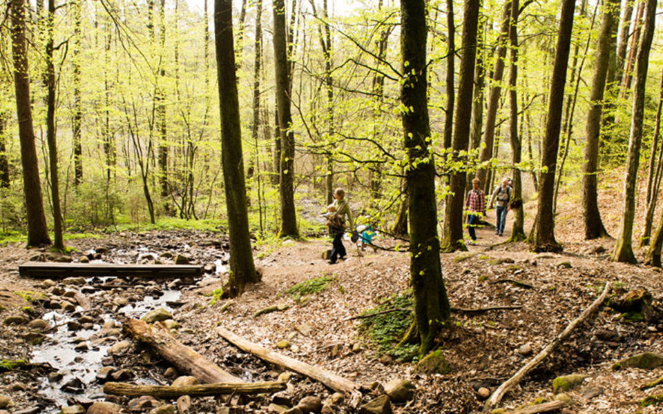
Ancient forces – the colliding of tectonic plates, and glaciers releasing massive quantities of water – shaped this section of trail in central north Skåne. The area is magically peaceful today but trolls once lived in the many rocky nooks and crannies.
Nature
The Vedema Recreation Area rests on a horst – Hörjaåsen Ridge. This horst, was forced up to a height of about 50 metres higher than the surrounding area when the European plate collided with the African plate millions of years ago. The northern section of this trail is scattered with boulders, all of which are geologically sensational. Some are from a time when Skåne was located at the equator and covered in rainforest. Others were transported here more recently at the end of the last ice age. As glaciers melted, enormous quantities of water moved and deposited everything from huge boulders to stone dust ultimately creating the Vedemaåsen Ridge, an esker several kilometres long.
Barsjön Lake, known for its fishing, was formed from a piece of stagnant ice which melted thousands of years ago. The Rökeån River meanders at the bottom of the valley often changing its course. This area provides many different eco habitats, and flora and fauna abound in the river, on the wetlands, and along the steep valley slopes.
As you move south, the countryside becomes more open and you come to Finasjön Lake. At the Hovdala Recreation Area there are valuable, ancient trees, some more than 400 years old. Some are protected, even one old dying beech tree. The decaying process itself is highly valuable as it draws a multitude of fungi. Beetles and other insects make their home in the rotted wood, which in turn draws birds and bats.
Cultural History
Along the northeastern shore of Finjasjön Lake, unmistakeable signs of human habitation – stone tools, burned bone, and fire-cracked rock – have been discovered, possibly dating as far back as 14,000 years ago. Remains have also been found from the Bronze and Iron ages, and of course from Medieval times as well.
In Swedish folklore, trolls occupied the steep cliff known as Vedema Hall. There is a legend of a troll kidnapping a little girl. In some versions, she gets free. In others, she does not. But fear of trolls did not stop people from settling here. The Rökeån River drove several water mills and by the bridge there are the remains of a mill, and a loom where rough, tough woollen cloth was spun.
At the sandy hills of Jontustorp, you come to the milestone which once marked the old highway. You can pause here, exactly as Carl Linneus, the father of modern taxonomy, did in 1749. And as you cross the Almaån River, consider its strategic importance. The Mölleröd fortress surrounded by a moat was built here in the 1580s, and the already poor farmers in the surrounding area had to provide the occupying soldiers, sometimes Swedish, sometimes Danish, with food to the point of complete ruination. The fortress was partially destroyed by fire in 1678 by Danes.
At the end of your journey is the estate of Hässleholmsgården, originally from the 1500s, but the current building was built in the early 1800s. Choose between the campsite and the hostel, or visit the town of Hässleholm for a pizza and perhaps the luxury of a hotel bed.
22 km
Degree of difficulty
About Difficulty Grading
The grading is tailored for Swedish lowland trails that adhere to the quality criteria established by the national framework for hiking trails.
Even and firm ground: The terrain is generally flat. The hike requires no need to use your hands for support. No obstacles. Bridges are always present when crossing waterways.
Uneven and/or soft ground: Some changes in elevation. Certain sections may require hand support to maintain balance. There may be obstacles such as low stiles and short stairs. Minor obstacles like stones and roots. Boardwalks are present.
Loose or slippery ground combined with steep sections: Technical parts require hand support. There may be obstacles such as high stiles and longer stairs. Frequent sections with stones and/or roots. Boardwalks with deeper surrounding water.
Note: One or more of these features may be present along the trail section.
Red
6-7 timmar
- Skog
- Storslagna vyer
- Stadsnära
- 15-26 km
- Lätt
- Barnfamiljer
- Skåneleden
Highlights along the section
Are you looking for a place to stay or a cozy cafe during your hike? Here are some of the sights and places to visit along the section.
Hiking suggestions
Do you find it difficult to know where to start your hike? Here is some inspiration and a selection of recommended hikes - short and long, with or without accommodation or based on different themes.
Show allNews
Here you will find information about what's new on the trail as well as current redirections and disturbances.
Continue on the trail
Share your moments
Share your adventures on the trail by tagging your photos with #skåneleden or #skaneleden.